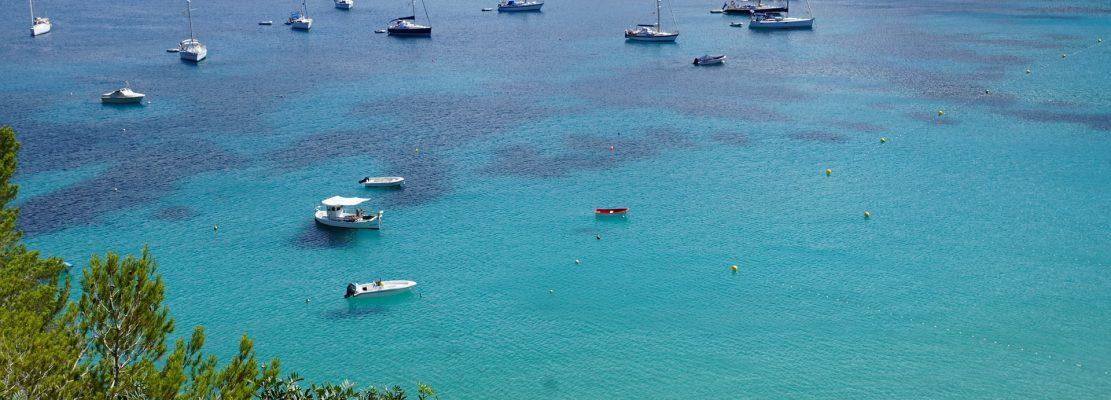
5 Navigation Hazards Between Ibiza and Formentera
OpenBoats
Ibiza’s clear water can make a boat trip look straightforward. But between Ibiza and Formentera, some passages contain shallow banks, submerged rocks and narrow channels used by everything from small motorboats to commercial vessels. Even an experienced skipper needs to plan carefully.
The areas that deserve particular attention are Es Freus, Sa Barqueta, Sa Torreta, the waters around Castelví and the shallow passage between S’Espalmador and the Trucadors peninsula. These are the five locations highlighted in Open Boats’ original Spanish guide. The risks differ from place to place, and none should be judged safe simply because the sea appears calm.
Important safety note: this is a general guide to boating hazards in Ibiza, not a navigation chart, pilot book or set of sailing directions. It does not identify safe channels, minimum depths or permitted routes. Before setting off, use up-to-date official nautical charts and notices, check the local forecast and follow the instructions of the charter operator and competent maritime authorities.
Where are the main boating hazards between Ibiza and Formentera?
The most frequently discussed hazards lie around the islets and shallow waters separating the two islands. Here is a quick overview of the five areas covered below.
| Area | What makes it challenging? |
|---|---|
| Es Freus (Los Freus) | Multiple channels, shallow ground, islets and busy marine traffic |
| Sa Barqueta | Submerged or partly obscured rocky hazards near the southern Ibiza coast |
| Sa Torreta | Limited depth and rocks near attractive-looking coastal shallows |
| Castelví / Castaví | Rocky shallows and restricted room for manoeuvre near S’Espalmador |
| Pas de S’Espalmador / Trucadors | Very shallow water, changing conditions, boat traffic and people in the water |
These are areas requiring extra care, not an official ranking of accident locations. Whether a passage is suitable depends on the specific vessel, its draught, the skipper’s competence, visibility, traffic and sea conditions.
1. Es Freus: the channels between Ibiza and Formentera
Es Freus (also known as Los Freus) refers to the passages through the chain of islets between the southern end of Ibiza and the northern approaches to Formentera. Names used in local descriptions include Freu Petit, Freu Mitjà and Freu Gros.
From the shoreline, the gaps can appear to offer convenient shortcuts. In reality, the area includes shoals, rocks and channels with different depths. Choosing a gap by eye, following another small boat or relying on a mobile phone map is not an adequate way to plan a passage.
Why extra care is needed at Es Freus
- Depth is not uniform. Sandbanks and rocky ground can lie close to apparently open water.
- Traffic can be substantial. Leisure boats share the wider area with ferries and other vessels travelling between Ibiza and Formentera.
- Wind and sea state matter. Conditions can differ noticeably from those experienced in a sheltered bay.
- Navigation rules apply. The Balearic Port Authority’s guidance treats the Freus passage as a narrow channel for the purposes of the relevant collision-prevention rules.
The Balearic Port Authority’s guidance on safe navigation in the Pityusic Islands specifically calls for a safe speed and particular care around Es Freus, islets, coastal waters and anchorages. Smaller recreational vessels must not obstruct vessels that can navigate safely only within a narrow channel.
Practical takeaway: do not treat Es Freus as a casual shortcut on a day out. Only plan a passage after checking the appropriate charts, restrictions and conditions for the boat concerned.
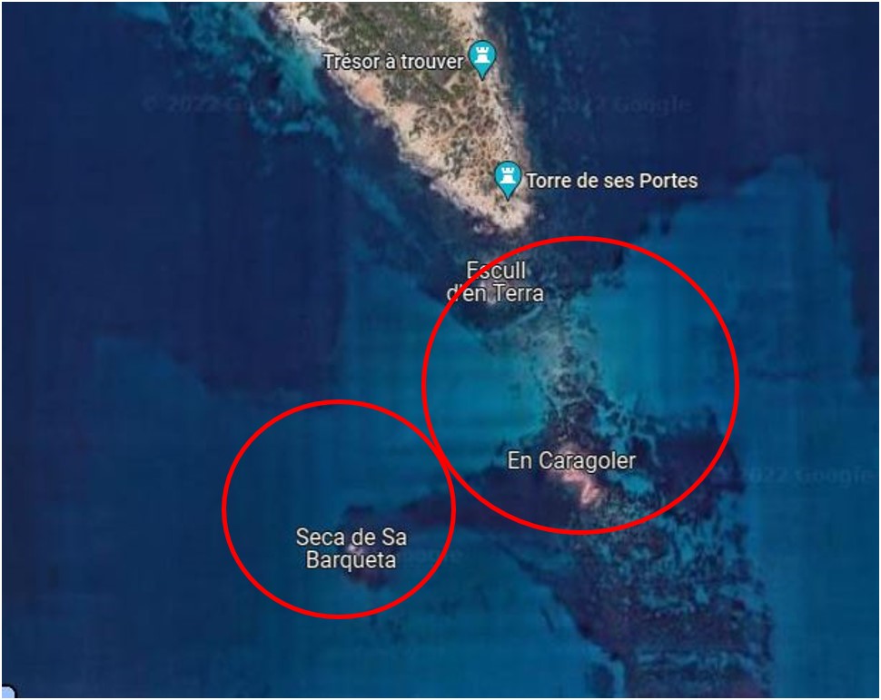
2. Sa Barqueta: hidden hazards near Ses Salines
The original Open Boats guide draws attention to Sa Barqueta, an area of rocky shallow water off the south of Ibiza, in the wider surroundings of Ses Salines and the Es Freus passages.
One of the difficulties with submerged rocks is that they may be harder to spot when the surface is smooth. Breaking waves can sometimes reveal shallow ground, but the absence of breaking waves does not mean the water is deep enough. Water colour is equally unreliable as a sole indicator of depth, particularly when reflections, cloud cover or swell affect visibility.
Do not approach an unverified patch of water in the hope of identifying the hazard at the last moment. The correct position of rocks and shoals must come from nautical information appropriate to the vessel, not visual guesswork.
What should a skipper check?
- The position of the relevant shoals on an up-to-date chart.
- The boat’s draught and the depth information available for the intended route.
- Any local notices, restrictions or advice given during the pre-departure briefing.
- Whether wind, swell and visibility make the proposed passage unsuitable.
If the safe water cannot be established confidently, do not proceed into the area.
3. Sa Torreta: shallow water beside an inviting coastline
Sa Torreta is another place mentioned in the Spanish article. Its scenic surroundings may tempt visitors to approach the shore for a closer look or a swimming stop, but shallow areas and rocky ground can make that decision hazardous.
A small boat is not automatically safe in shallow water. Even if its draught is modest, the propeller, lower unit, swell and lack of manoeuvring room all matter. A charted depth also cannot be interpreted without considering the conditions and the vessel’s actual characteristics.
Why getting closer is not necessarily better
As a boat approaches rocks or a beach, the skipper may have less time and space to react to a sudden gust, another vessel or someone entering the water. In a crowded area, slowing down is essential, but low speed alone does not remove the risk of grounding.
Enjoying a view from further offshore, where the route and depth have been properly checked, may be the more sensible option. Never assume that a location suitable for swimming or paddleboarding is also suitable for motorboat access.
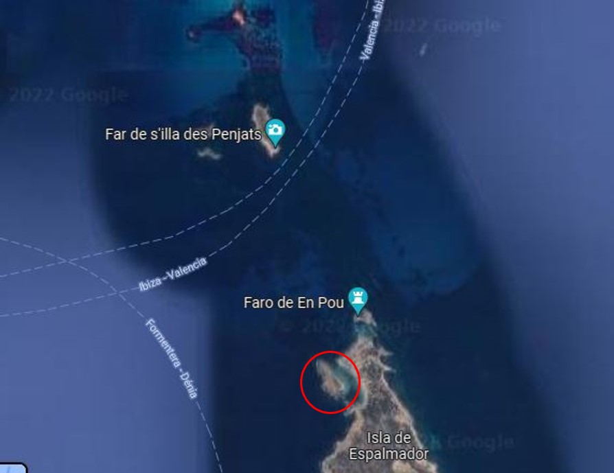
4. Castelví and Castaví: rocks near S’Espalmador
The original Spanish guide identifies rocky hazards in the waters between S’Espalmador and the Castelví islet, mentioning a rocky area locally described as Castaví.
It also suggested passing very close to Castelví to avoid other rocks. We have deliberately not repeated that instruction. Without a current chart, a confirmed vessel draught and the conditions at the time, telling visitors to keep close to an islet could create a false sense of security.
The correct approach is to understand that this is an area with hazards to be identified before departure. Do not follow an online description as if it were a set of helm instructions or a plotted course.
Can you stop or anchor near S’Espalmador?
There are protected habitats and regulated anchoring areas around S’Espalmador. A sheltered-looking bay is not necessarily somewhere you can drop anchor freely. Anchoring directly on Posidonia oceanica seagrass is generally prohibited in Balearic waters, and designated buoy fields may have additional rules.
The Balearic Government’s official Posidonia guidance explains the restrictions and the use of regulated mooring buoys. Check the current arrangements for your intended stop; do not infer permission to anchor from an old photograph or blog post.
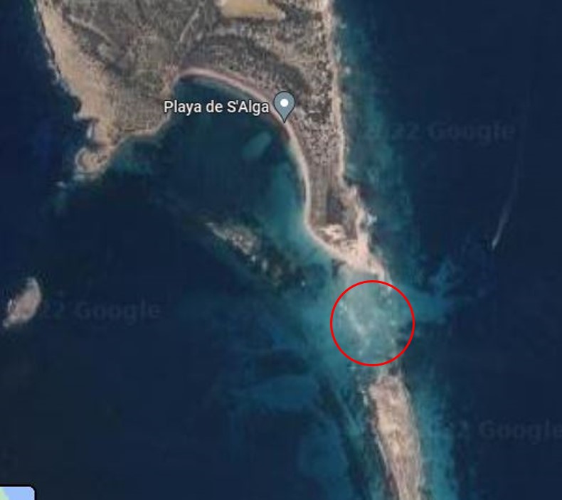
5. Pas de S’Espalmador and Trucadors: an especially shallow passage
The waters between S’Espalmador and the northern end of Formentera, around the Trucadors peninsula, can appear deceptively open. The Spanish article warns that the passage is shallow and that its seabed includes sandbanks.
It is also an area where holidaymakers may be in or near the water. That combination makes vigilance vital: shallow ground is a concern for boats, while propellers, wakes and passing vessels create risks for swimmers.
Do not assume that a visible strip of water is navigable. A passage that looks possible from a beach, a drone photograph or a social media video is not evidence that it is safe for your boat. Never attempt to cross shallow water simply because another vessel appears to have done so.
Before considering any visit to this part of Formentera, verify the navigation and environmental restrictions and whether the proposed activity is suitable for your boat and crew.
Other situations that can make boating around Ibiza dangerous
The five locations above are the focus of the original article, but navigation risk is not limited to named rocks and shoals. Sometimes the greatest hazard is the combination of weather, speed and traffic.
Busy harbour approaches
Take particular care when approaching or leaving the ports of Eivissa and La Savina. Commercial vessels may have limited room to manoeuvre, while recreational traffic and port-specific rules require constant attention.
The Port Authority publishes speed limits and local arrangements for these harbours. These are not universal limits for all of Ibiza: follow the current signs, notices and instructions for the relevant port rather than assuming the same speed applies everywhere.
Exposed headlands and changing weather
A bay sheltered from the wind can be comfortable while the sea outside it is quite different. Gusts, swell and wind-against-sea conditions can make an exposed passage rougher than expected. A forecast showing sunny skies does not, by itself, establish safe boating conditions.
Check the AEMET marine forecast for the Balearic Islands, paying attention to the separate coastal forecasts for Ibiza and Formentera, wind, sea state and warnings.
Swimmers, paddleboards and anchoring areas
Near beaches and coves, expect people in the water, small craft and vessels entering or leaving anchorages. Maintain a proper lookout, keep to permitted navigation areas and adapt speed so that you can take effective action to avoid a collision.
How to plan a safer boat trip in Ibiza
Most avoidable problems begin before the boat leaves the berth. Whether you are hiring a motorboat or travelling with a professional skipper, these checks help you make a more informed decision.
1. Plan with nautical charts, not tourist maps
Use suitable, current nautical charts showing depths, rocks, buoys and navigational marks. Check updates and notices to mariners. Spain’s Instituto Hidrográfico de la Marina is the official hydrographic authority and publishes chart information and notices.
Plotting a route on a phone is not a substitute for appropriate navigation equipment, knowledge and backup arrangements. Know how to interpret the information before you rely on it.
2. Check the forecast for the actual route
Look at wind direction and strength, sea state, swell, visibility and the time needed to return. Do not rely on a fixed rule such as “mornings are always safe” or “the sea will be calm after lunch”. Conditions can change during the same day.
Set sensible limits for postponing, shortening or cancelling a trip. A route that was appropriate for one boat yesterday may be inappropriate for another vessel today.
3. Confirm the boat’s permitted operating area
Check the boat’s documentation, navigation limits, equipment, fuel and any restrictions imposed by the rental operator. A destination being geographically nearby does not automatically make it an authorised or suitable route.
If you are unfamiliar with the options, our guide to types of boats to hire in Ibiza explains how to compare boats before reserving. For qualification-related questions, read the Ibiza boat licence guide.
4. Brief everyone on board
- Identify where the correctly sized lifejackets and other safety equipment are kept, and when they must be worn.
- Explain how to move safely around the boat and why hands and feet must be kept clear when berthing.
- Agree on what to do if someone falls overboard and ensure a reliable means of raising the alarm.
- Keep communication equipment accessible and protected from water.
- Tell a reliable contact about your general plan and expected return, where appropriate.
Follow the pre-departure checklist from Spain’s Maritime Rescue Service rather than relying on an informal checklist alone.
5. Keep a proper lookout and reduce speed when necessary
A safe speed is one that allows the skipper to assess hazards and react in time. It may be considerably lower near swimmers, other boats, islets, poor visibility or restricted channels. Maintain awareness of commercial shipping and never assume a ferry can easily alter course to avoid you.
6. Leave a margin for the return trip
Allow for changing conditions, delays, fuel reserves and daylight where relevant. Do not rush back at excessive speed because you have planned too many stops. If a route is no longer suitable, change the plan rather than forcing the original itinerary.
What to do if something goes wrong at sea
If you are in difficulty, act early and prioritise the safety of everyone on board. Keep people away from hazards, make sure lifejackets are being used as appropriate and communicate your position as accurately as possible.
For a grave and imminent danger, use the appropriate maritime distress procedure: VHF Channel 16 where suitable radio equipment is available and the user is competent to operate it. In Spain, you can also call 112 or contact Salvamento Marítimo on 900 202 202. Do not rely on mobile coverage alone.
Tell the rescue services what has happened, your position, the number of people aboard and the assistance needed. Follow their instructions. These contacts are also included in the Balearic Port Authority’s safety guidance.
Should you hire a boat with a skipper in Ibiza?
If you have limited experience or want to explore an unfamiliar stretch of coast, hiring a professional skipper can be a sensible choice. A skipper can assess the weather, the vessel’s limitations and whether a proposed route is appropriate, while you focus on enjoying the trip.
Open Boats operates from Sant Antoni de Portmany (San Antonio) and offers boat hire with a skipper in Ibiza. Availability of particular itineraries, including any proposed trip towards Formentera, must be checked with the team for the chosen vessel and conditions. You should not assume that every rental boat can travel through Es Freus.
For an overview of how the islands are connected, see our Ibiza to Formentera travel guide. If you want to check which type of boat or trip may be suitable, contact Open Boats before booking.
Frequently asked questions about boating hazards in Ibiza
What is the most dangerous area to navigate near Ibiza?
There is no single area that is always the most dangerous. Es Freus deserves special attention because it combines channels, shoals, islets and substantial maritime traffic. Risk depends on the vessel, weather and route, so current nautical information is essential.
Is it safe to sail from Ibiza to Formentera?
The crossing is regularly made by suitable vessels, but that does not make every route or every day’s conditions safe. Use a properly equipped and authorised boat, check the forecast and charts, and make sure the skipper has the appropriate qualifications and experience.
Can small motorboats navigate through Es Freus?
Boat size alone does not determine whether a passage is appropriate. Depth, draught, traffic, sea conditions, the boat’s documentation and the skipper’s competence all matter. Do not attempt an unfamiliar passage based only on the boat being small.
Why are the waters around S’Espalmador risky?
Some areas contain very shallow sandbanks and rocky ground, while boats and people in the water may be close together. There are also environmental restrictions, including protections for Posidonia seagrass and regulated anchoring areas.
What is the best time of day to navigate safely in Ibiza?
There is no universally safest hour. Choose your departure and return times according to the marine forecast, local traffic, daylight requirements and the abilities of the skipper and crew. Postpone or alter a trip if the conditions are unsuitable.
Which emergency number should I use when boating in Ibiza?
In a maritime emergency, use VHF Channel 16 when available and appropriate, or call 112. Salvamento Marítimo can also be reached on 900 202 202. Give your location and explain the nature of the emergency as clearly as possible.
In short: the safest way to enjoy Ibiza from the sea is not to memorise a list of supposedly forbidden places. It is to recognise the hazards, choose a suitable boat and route, use current charts and forecasts, and be ready to change your plans when conditions demand it.